Survey
Because the enhanced conductivity due to high salinity can be sensed by EM induction, an airborne time domain survey and an airborne frequency domain survey were flown in 2006 and 2008 respectively at Bookpurnong.
Frequency domain system
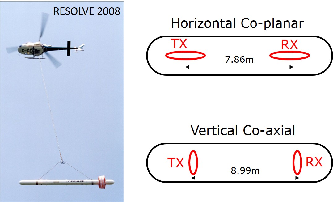
The airborne frequency-domain system used at Bookpurnong was RESOLVE (Fig. 349), operated by Fugro Airborne (now CGG). It operates five pairs of horizontal co-planar (HCP) loop- loop configurations at 382, 1822, 7970, 35920 and 130100 Hz, and one pair of vertical co-axial loop-loop configuration at 3258 Hz. The measured secondary magnetic field (Hs) is represented as the ratio to the primary field (Hp) in part per million. As the towded bird moves forward along flightl lines, the system continuously records the data (Hs/Hp) for every loop-loop pairs at the corresponding frequencies.
Survey design
The loop configuration of an airborne EM system is mostly fixed, so the primary consideration in survey design is the sounding spacing. For a towed system, the in-line spacing is adjustable by the flight speed and sampling rates, and can easily achieve high density. The cross-line spacing is usually a trade-off between the cost and resolution.
The background conductivity at Bookpurnong is about 1 S/m. For this setting, the skin depths of the : RESOLVE III system specifications frequencies range from about 1 to 25 m, a spatial scale appropriate for near-surface environmental studies. In reality, the : RESOLVE III system specifications system was flown in a 100 m cross-line spacing. This may not be dense enough to avoid gaps, but could still be reasonable if taking into account the geology that is mostly horizontal or sub-horizontal.
Time domain system
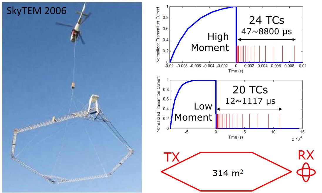
The airborne time-domain system used at Bookpurnong was SkyTEM (Fig. 350), operated by SkyTEM Surveys Aps. Its transmitter is a large loop and its two receiver loops are mounted at the rear of the frame, in orthogonal orientations measuring dB/dt in z (vertical) and x (in-line horizontal) directions. The final data are normalized as if the dipole moments of the transmitter and the receiver are both unity. One special feature of SkyTEM is its capability of operating in dual-mode - transmitting a high moment pulse and a low moment pulse sequentially. A high moment pulse has greater penetrating depth, but is difficult to cut off clearly in electronics, causing unaccepted bias in the early times. A low moment does not see very deep, but has cleaner early time channels. The high moment is 113000 NIA at 25 Hz and the low moment is 12560 NIA at 222.22 Hz at Bookpurnong.
Survey Design
Using the background conductivity of about 1 S/m, the diffusion distances of the : SkyTEM (2006) system dual-mode specifications time channels range 4 to 120 m. At Bookpurnong, the SkyTEM was flown at a 100 m line spacing, so any single location can be at least sensed by two flight lines. Fig. 351 shows the flight lines of RESOLVE and SkyTEM. The two surveys covered almost the same area, providing us with an opportunity to cross validate the resulting models.
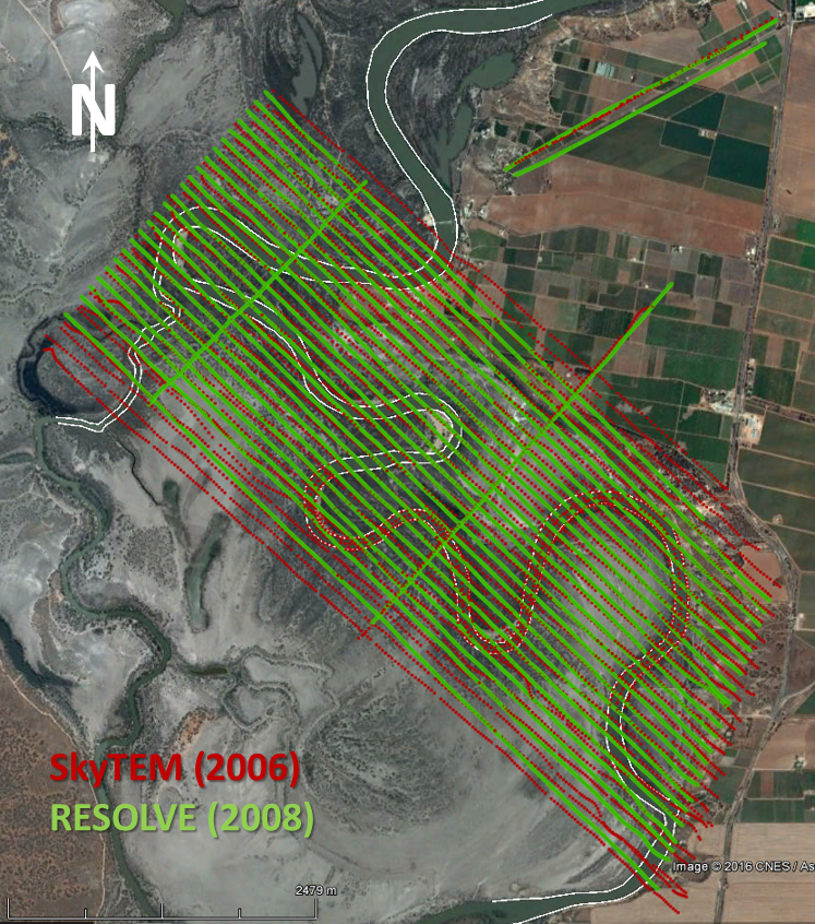
Fig. 351 RESOLVE and SkyTEM flight lines at Bookpurnong.