Setup
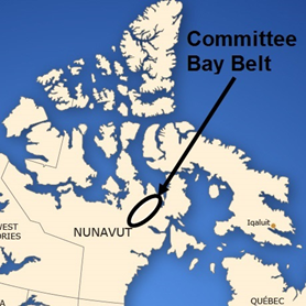
Fig. 540 Location of Committee Bay Greenstone Belt within which the West Plains area resides.
The West Plains region resides in the South-West corner of the Committee Bay Greenstone Belt of Nunavut (Fig. 540). A simplified geology map of West Plains is shown in Fig. 541 with the outline of overlapping frequency and time-domain AEM surveys in black.
The geology consists of a series of steeply dipping, near-surface ultramafic komatiite units shown in dark purple, named the Prince Albert Group, that cut through a sediment package shown in light purple [Ker96]. The komatiites and sediments are bounded by granodiorites to the North-West and tonalites to the South-East. The komatiites contain the majority of the gold mineralization, and imaging their 3D nature to a higher degree represents the focal point of this study.
Geologic outcrops are scarce in the West Plains region, as the majority of the area is covered with a thin layer of glacial material. As a result, the simplified geology map is compiled mainly from regional magnetic data analysis. This geologic interpretation does not include information from AEM data, which means the geologic interpretation from Fig. 541 has plenty of room for improvement based off 3D AEM inversion results. From the geology and drilling, it is believed that three conductive units exist, comprised of a Western main conductor, numbered 1 on Fig. 541, and two near-parallel conductors in the East, numbered 2 and 3.
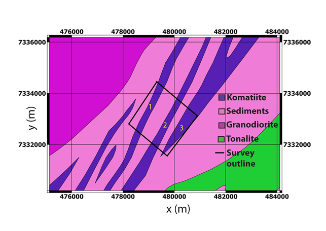
Fig. 541 Simplified West Plains geology map with major lithology units defined and location of overlapping frequency and time-domain AEM surveys outlined in black. Conductive komatiite units of interest are numbered in yellow.