Setup
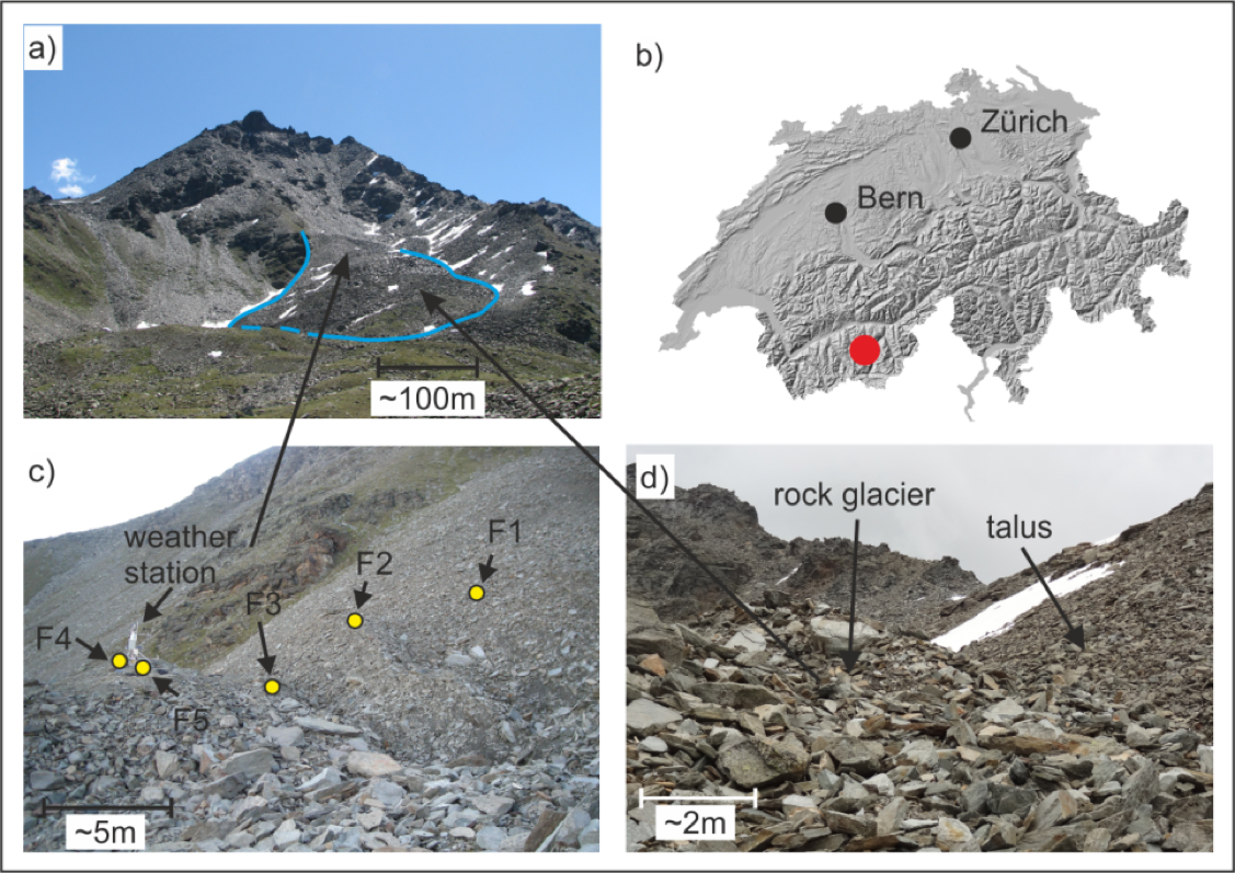
Rock glaciers are large lobate shaped bodies that vary from masses of ice overlain by boulders and debris to accumulations of boulders and debris glued together by ice [BDG99]. They are ubiquitous in the mountains of most continents, with tens of thousands worldwide [Bar96]. Our study site on the Furggwanghorn rock glacier is located in the western Swiss Alps (Fig. 408 a and b). This boulder dominated rock glacier is ~360 m long and ~180 m wide at an altitude of 2750 ‑ 2900 m asl [BMZ+13]. Various studies show that its downslope movement has recently accelerated from 1.5 m/yr to as much as 4.0 m/yr in some places ([BMZ+13]; [MGB+15]).
The primary questions addressed in this Case History are:
Can surface-based GPR surveying provide reliable subsurface information for the Furggwanghorn rock glacier? Comparing GPR images from nearly coincident lines recorded at different times are used as reliability tests.
Is it possible to improve the reliability of GPR images by recording the data using a helicopter mounted system (i.e. H-GPR)? Reliability is tested in the same manner as for the surface-based images.
Is it possible to image the bedrock beneath the rock glacier using H-GPR?
Can H-GPR data acquired along closely spaced lines and limited intersecting lines be used to construct a dependable 3D image of the entire Furggwanghorn rock glacier?
Does such a 3D GPR image provide new insights into the rock glacier’s evolution and continuing development?

Fig. 408 Frontal view of the Furggwanghorn rock glacier (outlined in blue) (a). Location (red dot) within Switzerland (b). Depressions and positions of boreholes F1 - F5 and weather station (c). Blocky surface and talus slope (d).
Geology
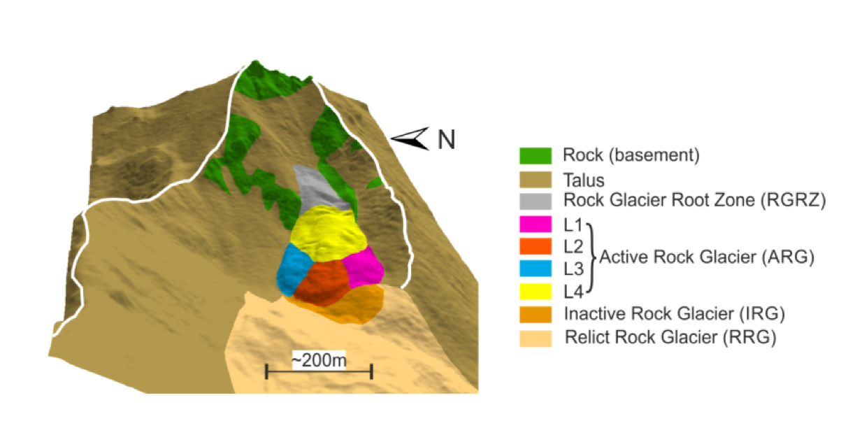
Bedrock underlying and surrounding the Furggwanghorn rock glacier comprises schists and gneisses [BMZ+13]. Erosion of these rocks produces the talus that is the source of the rock glacier material, which ranges from large jagged boulders to gravel, sand and silt (Fig. 408 c and d). A combined interpretation of air photographs and ground observations has demonstrated the presence of four distinct lobes L1 - L4 at the rock glacier surface (Fig. 409). Movement of the rock glacier has been controlled by the movements of these lobes.
The rock glacier is close to the lower thermal permafrost boundary, such that the permafrost temperatures are close to 0°C. As a result of the downslope movements, deep surface depressions have formed near the root zone of the rock glacier (Fig. 408 c).

Fig. 409 Geological/geomorphological units of the Furggwanghorn rock glacier. L1 - L4 are rock glacier lobes that are identified at the surface and in the H-GPR images.