Synthesis
In the synthesis, we examine how the interpreted geophysical image agrees with the known geologic knowledge and how the questions in the Setup are answered.
First, the ore lenses’ model built from the drilling is overlaid on the geophysical image (Fig. 441). The pink shapes indicate the position and geometry of the massive sulphides, and the green underneath the pink is for the stringer sulphides. The geophysical image successfully captured both the position and the dipping geometry of the major ore lenses at Lalor. Second, the small and vertical conductor is outside of the geologic model, but new drilling has revealed that it is a sulphide-bearing argillite.
The application of HeliSAM survey and 3D inversion confirmed the drilling results of the deep ore lenses at Lalor. Geophysics also portraits a more complete picture about the subsurface, as other geologic units around the mineralization complex are imaged.
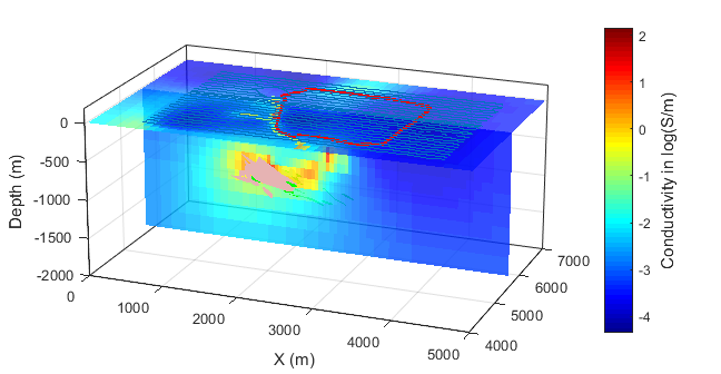
Fig. 441 3D HeliSAM inversion model with geologic overlays.