Survey
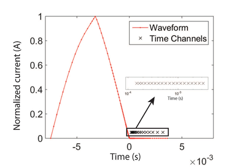
Fig. 543 West Plains VTEM survey locations over simplified geology map.
In 2003, a time-domain VTEM survey was flown over West Plains with largely a 120 m line spacing with a few 60 m spaced lines in the North to image some preliminary targets. The lines are shown in black in Fig. 544 along with the geology map for reference. The line direction of 310 degrees was chosen in order to cross the komatiite units in a roughly perpendicular fashion. The system used a coincident loop setup with a transmitter coil diameter of 18.5 m, a peak current of 110 A, and z-component dB/dt measurements were collected from 26 time channels ranging from 110 \(\mu s\) - 6340 \(\mu s\). The waveform used a 7.5 ms on-time pulse as shown in Fig. 543, but the precise waveform after current shut-off was not recorded. The average terrain clearance of the system was 26 m, which is quite low for a time-domain system, and was only achieved due to relatively flat topography in the area. In this case study, 20 time channels are analyzed from 150 \(\mu s\) - 3180 \(\mu s\).
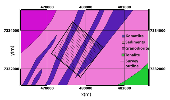
Fig. 544 West Plains VTEM survey locations over simplified geology map.
In 2005, a frequency-domain RESOLVE survey was flown over the same region of West Plains with largely a 60 m line spacing in order to obtain more resolution over the main region of interest. The lines are shown in red in Fig. 545 along with the geology map for reference. Once again a line direction of 310 degrees was chosen. The system collected co-planar measurements at five frequencies (385, 1500, 6200, 25,000 and 115,000 Hz) as well as co-axial measurements at 3300 Hz. The average terrain clearance of the system was 30 m. This case study focuses on the co-planar measurements, although with some noise removal and filtering, the co-axial data could provide valuable information.
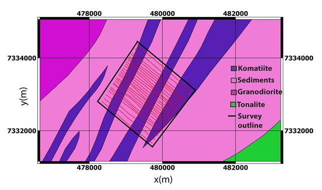
Fig. 545 West Plains RESOLVE survey locations over simplified geology map.