Setup
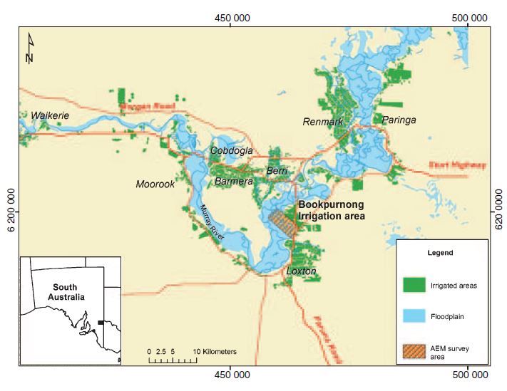
The survey area under investigation is along Murray River in the Bookpurnong Irrigation District of the Riverland region of South Australia (Fig. 344). The river regulation and irrigation along Murray River have significantly changed the hydrology of the floodplain. One of the most damaging consequences is the accumulation of salt in the plant root zone. Such increased salinity of the floodplain soil has triggered decline in vegetation health over years. In response to the ecological crisis, a major effort called Living Murray Initiative was launched in 2002 to study and restore the impacted hydrological system. As part of the Initiative, the Clark’s Floodplain at Bookpurnong was chosen to examine the effectiveness of different intervention methods from 2005 to 2008. Because of the link between groundwater salinity and electric conductivity, electromagnetic (EM) methods have been an integrated part of the project to test it as a cost-effective tool for invasive monitoring. In this study, we analyze two airborne EM data sets that assess the salinization at the regional scale. The primary motivating questions are:
How EM can be used to reconstruct an electrical conductivity model for the entire region?
Can the conductivity model, a proxy of the severity of salinization, reveal the dynamics of groundwater flow?
Hydrological Background
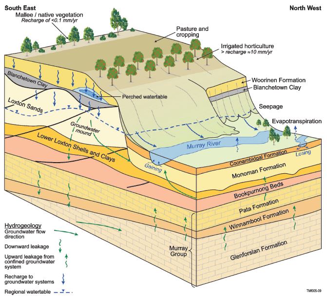
The hydrological system concerning groundwater salinization at Bookpurnong involves a highland and a floodplain as shown in Fig. 345. The irrigation on the river bank (highland) has recharged the groundwater and formed a hydraulic gradient towards the floodplain. The groundwater flow from the high land to the the floodplain brings in substantial amount of natural saline water to the river, causing tree health problems. In order to reduce salt accumulation, Bookpurnong Salt Interception Scheme (SIS) is implemented to experiment the water management methods that use pumping and flooding, with a hope of replacing the saline water with fresh water.
In hydrology, the interaction between the riverwater and groundwater can be in two modes (Fig. 346). If the groundwater table is lower, the riverwater recharges the groundwater aquifer, causing the river to “lose” water. If the groundwater table is higher, the groundwater can recharge the river, causing the river to “gain” water. Normally the former is the case if the river is healthy. However, at Bookpurnong, the Murray River floodplain salinization is associated with “gaining” saline water from the irrigated highland. So the hydrological question here is where Murray River loses or gains water, and whether the SIS improves the salinization. These questions can be partially answered by hydrological drilling and sampling, but those data are spatially confined. In this study, we will use EM methods to identify the losing and gaining streams of Muaary River at Bookpurnong.
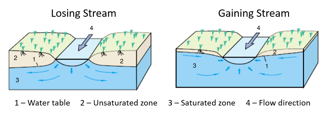
Fig. 346 Losing and gaining stream of a river.