Survey and Data
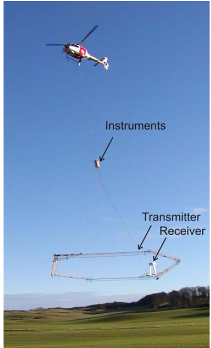
Fig. 424 Configuration of the SkyTEM system.
The airborne transient electromagnetic data (Fig. 425) were acquired with the SkyTEM system. SkyTEM is a time-domain helicopter electromagnetic system designed for hydrogeophysical, environmental and mineral investigations. The system is shown in operation in Fig. 424. The SkyTEM system is carried as an external sling load independent of the helicopter. The transmitter, mounted on a lightweight frame of composite material in an eight-sided polygon configuration, is a four-turn about 340 m \(\!^2\) eight-sided loop divided into segments for transmitting a low moment (LM) in one turn and a high moment (HM) in all four turns. The LM is about 10 A with a turn-off time of about 3.3 microseconds; the HM transmits approximately 110 A and has a turn-off time of about 49 microseconds for the Kasted survey. This yields a maximum magnetic moment of approximately 150000 Am \(\!^2\).
In this survey, the early-time data have been corrected for the primary field response. This allowed unbiased data to be obtained from as early as 7 \(\mu s\) after beginning of ramp down (equivalent to 3 \(\mu s\) from end of ramp) for the super low moment. The last gate was centred at 9 ms. The very early times carry information about thin layers, in the order of a few meters, in the upper c. 20 m. At the same time, layers in more than 250 m depth can be mapped, although with both decreasing lateral and vertical resolution and highly dependent on the resistivity structure. The survey covers 333 line km with a line spacing of 100 m.
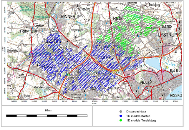
Fig. 425 Location of the Kasted survey area. (A) Study area. (B) Location of the data. Black dots markd the positions of SkyTEM soundings remaining after processing. Soundings are so closely spaced that they appear as black lines. Boreholes within the study area are shown with colours according to their depths.